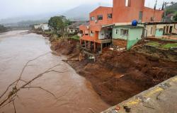
Rain will come with lightning in several cities as the cold front arrives | FABIANO GUTIERRES/FILE
MetSul Meteorologia warns of the risk of isolated storms in Rio Grande do Sul as a cold front moves. The instability that will advance from neighboring countries will reach the state of Rio Grande do Sul today, during Thursday and part of Friday, with rain in all regions of Rio Grande do Sul and the possibility of localized severe weather.
Strong areas of instability at the front of a cold front are forming this Wednesday in Central Argentina and Uruguay with a tendency to move towards Rio Grande do Sul, where they could cause locally heavy rain and thunderstorms in some places with lightning and gusts of wind.
The frequency of cold fronts tends to increase from this time of year onwards as cold air masses advance more regularly across Argentina. This means that the intervals between rain events end up being shorter.
In Argentina, the National Weather Service (SMN) issued yellow and orange alerts for this Wednesday for the provinces of Buenos Aires, Santa Fé, Entre Ríos and Corrientes with the highest risk indicated for Entre Ríos, west of Uruguay.
As for Uruguay, where instability will act today before reaching Rio Grande do Sul, the Uruguayan Institute of Meteorology issued a warning to the population warning of “strong and very strong storms accompanied by occasionally heavy rain”. The statement highlights that “in stormy areas, intense rain occurs in short periods, strong and very strong wind gusts, hail and electrical activity”.
GOES-16 satellite image from late Wednesday morning showed the cold front in the province of Buenos Aires and strong areas of instability in its front | METSUL
Instability begins to enter Rio Grande do Sul from the afternoon to the evening of this Wednesday and throughout the morning of this Thursday through the border area with Uruguay. Over the course of Thursday, instability advances to the North and affects other regions of the state of Rio Grande do Sul.
See what is expected to happen in the next 36 hours. The maps below show the projected evolution of instability for tonight (3) and the course of Thursday (4) based on data from the high-resolution WRF model from MetSul Meteorologia, available to subscribers (subscribe here).

METSUL
According to our analysis, the greatest risk initially will be heavy rain in isolated points in the West and South with the possibility of lightning and occasional isolated storms of wind or hail. As Thursday progresses, the risk will transfer to other areas of the state.
We emphasize that no scenario is projected like March 21st, when storms with gales hit all regions of Rio Grande do Sul during the passage of a cold front. Now, any occurrences of severe weather tend to be more punctual, with no storm projected for the vast majority of cities in Rio Grande do Sul, although the risk exists in different parts of Rio Grande do Sul’s geography.
On Friday, instability will still affect the Northern Half of Rio Grande do Sul for part of the day, while drier and colder air will begin to advance from the West and South, which will bring a Saturday in the state of sunshine and pleasant temperatures, typically in April.
MetSul Meteorologia is on WhatsApp channels. Subscribe here to access the channel in the messaging app and receive forecasts, alerts and information about the most important events in the weather and climate in Brazil and around the world, with exclusive data and information from our team of meteorologists.
Tags: Cold front advances Argentina bring rain isolated thunderstorms
--


