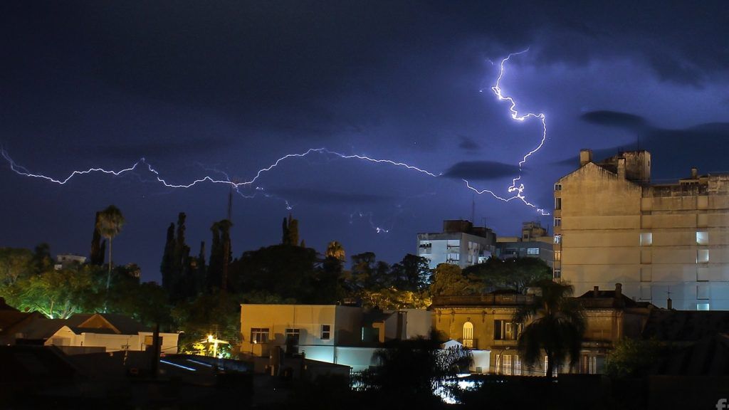

Warm front will favor lightning in several cities this Friday | FABIAN RIBEIRO
The ingress of very hot air from Northeast Argentina creates a hot front over Rio Grande do Sul this Friday. The system will act throughout the day in the West, Center, South and East of Rio Grande do Sul, bringing rain and the risk of isolated storms to the state.
Satellite images from early Thursday evening already showed the presence of heavier clouds entering from the northwest of Rio Grande do Sul and accompanying the arrival of warmer air. Instability advances throughout the night to the South and East with rain in more regions.
Unlike a cold front, which is driven by cold air, a warm front has its movement dictated by the advance of warm air. Therefore, its movement in the state is from North to South, unlike cold frontal systems that advance from South to North. This is also why after the passage of the warm front it heats up a lot, unlike the cold front which brings a drop in temperature.
Warm fronts traditionally occur in autumn and winter, especially in June, and usually bring locally heavy to intense rain, lots of lightning and hail. Although isolated thunderstorms with wind may occur, heavy rain, lightning and hail are more common than wind on warm fronts.
This hot front should not be intense, but there is a risk of locally heavy rain with lightning and occasional isolated thunderstorms this Friday in sectors of the West, Center, South and East of the state. Normally, these are the regions that suffer the effects of a warm front, when it is already organized.
There is a risk of heavy rain in some places with lightning and occasional isolated hail. In the West, North and Northwest Border, warm air enters and the sun appears hot this Friday. Highs will exceed 30ºC in the Northwest. Part of the Center and East of Rio Grande do Sul will have rain and then the weather will improve with muggy air. In the South, the heaviest rain occurs in the second half of the day.
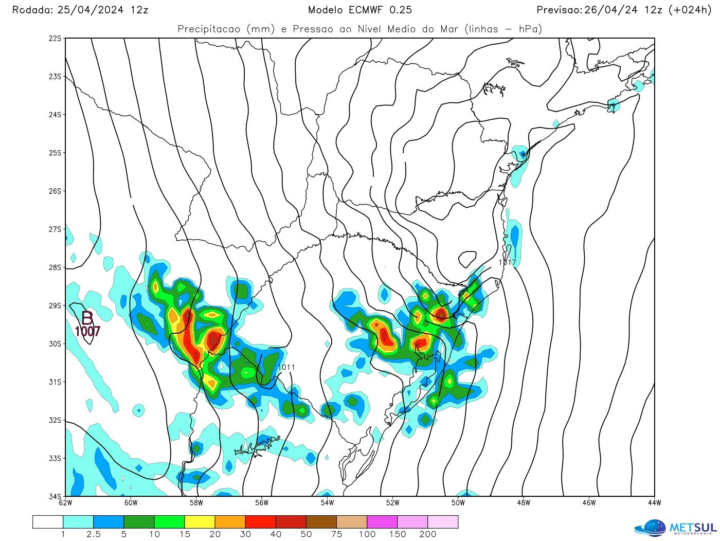
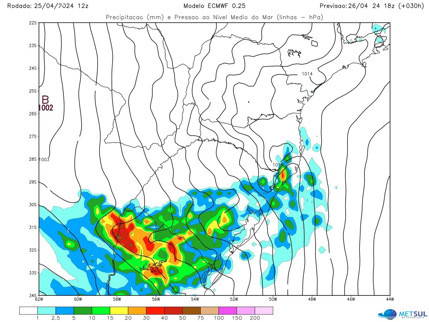
The sequence of maps below shows the trend of the European Meteorological Center (ECMWF) model for this Friday, which can be consulted by subscribers in the maps section (subscribe here), in which the tendency for instability to advance from North to South throughout the day is observed, with areas of heavy rain and the risk of isolated thunderstorms in Rio Grande do Sul and also in Uruguay.
METSUL
METSUL
METSUL
This Friday’s instability is part of a scenario of many days in a row with rain that is expected for Rio Grande do Sul until the beginning of May, although there will be moments of improvement. As warned by MetSul (click here and read the alert), excessive amounts of rain and isolated storms can be expected in the state at the end of April and the beginning of May.
On Saturday, the front will be over the south of Rio Grande do Sul early in the day and will begin to move north, this time as a cold front, as it is being driven by milder air, which will bring the rain back to most areas. regions of Rio Grande do Sul, especially the Center, South and West of the state.
Before the rain, which hits the South early, the sun appears hot in most areas of the state and the temperature in many cities will be quite high towards the end of April with strong to intense heat. When the front encounters warm air, it could generate heavy rain and thunderstorms as it advances across the state.
MetSul Meteorologia is on WhatsApp channels. Subscribe here to access the channel in the messaging app and receive forecasts, alerts and information about the most important events in the weather and climate in Brazil and around the world, with exclusive data and information from our team of meteorologists.


